|
Know what’s happening across Oceania—before your coffee’s cold.
TODAY IN OCEANIA
Today is Day of Reconciliation!
Day of Reconciliation focuses on addressing the harms of past conflict and injustice through truth, dialogue, and accountability. It calls for understanding and respect in everyday actions—change starts with how we treat one another today.
|
OCEANIA MARKETS
|
S&P/ASX 200
|
8,631.80
|
-0.75%
|
|
|
S&P/NZX 50 Index Gross
|
13,342.41
|
-0.48%
|
|
|
SPX STRI Fiji
|
9764.35
|
-0.03%
|
|
ASX 200 and NZX 50 Data Provided By:

|
|
*Market index data sourced from official exchange publications and financial data aggregators. ASX and NZX data reflect end-of-day figures from the Australian and New Zealand stock exchanges respectively. SPX (South Pacific Stock Exchange) figures reflect the most recent published data. Note: NZX and SPX figures include dividends (total return), while the ASX figure reflects share price movement only.
|
|
REGIONAL NEWS
The first residents of Tuvalu have begun relocating under a bilateral visa program as rising seas threaten their Pacific homeland. Photo credit: Hall Contracting
First Tuvaluans Resettle in Australia Under Climate Migration Treaty
|
The first residents of Tuvalu have arrived in Australia under a bilateral climate visa program capping intake at 280 people annually from the 11,000-person Pacific nation. Over one-third of Tuvalu's citizens applied for the program, established through the 2023 Falepili Union treaty. Among those relocating are a forklift driver, a dentist planning to work with Indigenous communities in Darwin, and a pastor tasked with maintaining spiritual connections for the diaspora. Prime Minister Feleti Teo emphasized the importance of maintaining strong ties and cultural bonds across borders as citizens migrate. The visa provides permanent residency with immediate access to subsidized education, Medicare, and unlimited travel between the two countries—arrangements that give Tuvalu the "second closest migration relationship with Australia after New Zealand".
|
|
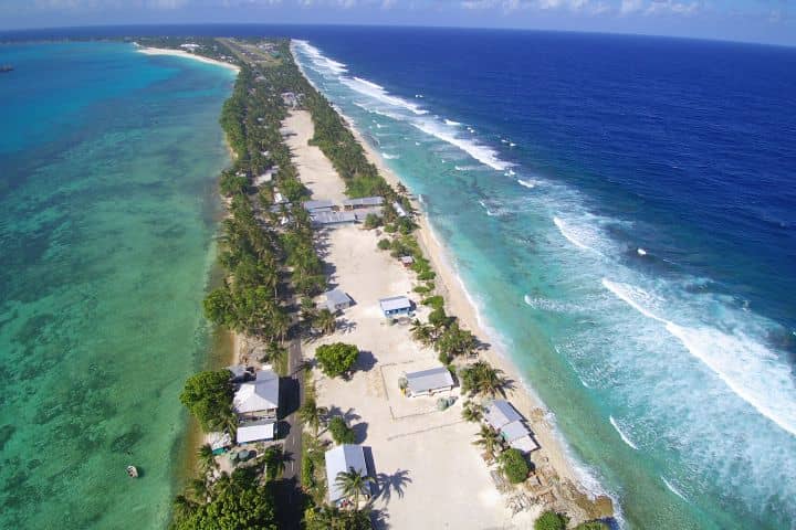
NASA's 2023 assessment found sea level in Tuvalu nearly 15 centimeters higher than 30 years prior, with an average increase rate of 5 millimeters per year—1.5 times faster than the global average and expected to more than double by 2100. Much of the land area and critical infrastructure will sit below the average high tide level by 2050. On Funafuti atoll, home to 60% of Tuvalu's population, land is barely wider than the road in many stretches, with villages clinging to strips as narrow as 20 meters. By century's end, projections show 90% of Funafuti could be underwater under worst-case scenarios.
|
|
The treaty includes security provisions requiring Australia to defend Tuvalu against natural disasters, health pandemics, and military aggression, while also giving Australia influence over Tuvalu's other defense agreements. The visa remains open to those "with disabilities, special needs and chronic health conditions"—typically a barrier to Australian immigration—and does not require applicants to demonstrate climate-related risks despite the program's origins. With the 280-person annual cap, it would take almost 40 years for all Tuvaluans to relocate, though the treaty explicitly states that "the statehood and sovereignty of Tuvalu will continue, and the rights and duties inherent thereto will be maintained, notwithstanding the impact of climate change-related sea-level rise".
|

Jovilisi Suveinakama assumes non-resident role representing Fiji to the Holy See while maintaining London post. Photo credit: The Fiji Government / Facebook
Fiji Appoints UK-Based High Commissioner as Vatican Ambassador
|
Jovilisi Suveinakama presented his letters of credence to Pope Leo XIV on December 6, formally assuming his position as Fiji's non-resident ambassador extraordinary and plenipotentiary to the Holy See. Suveinakama currently serves as Fiji's High Commissioner to the United Kingdom and will hold both positions concurrently—a common arrangement for smaller nations managing diplomatic costs while maintaining Vatican ties. The ambassador conveyed greetings from Fiji's president and prime minister, reaffirming the country's commitment to working with the Vatican on peace, human dignity, and sustainable development. Fiji maintains formal diplomatic relations with the Holy See, which represents the Vatican as a sovereign entity in international affairs and holds relations with 184 states worldwide.
|
|
Suveinakama holds law degrees from the University of Waikato and has practiced in New Zealand, Fiji, Samoa, and Tokelau. Before his diplomatic appointment, he served as chief policy advisor to Tokelau's government from 2010 to 2017 and as secretariat to the Polynesian Leaders Group in 2015. Catholics comprise approximately 9.1% of Fiji's population—around 83,000 people—with about 75% being indigenous Fijians. The Holy See's Apostolic Nunciature for Fiji operates from Wellington, New Zealand, serving multiple Pacific island nations where establishing individual resident missions would be impractical due to size and resources.
|
|
The credential ceremony included 13 ambassadors from countries including Uzbekistan, Moldova, Sri Lanka, and Micronesia, held in the Vatican's Clementine Hall. The Holy See maintains diplomatic relations with all Pacific island nations except Tuvalu, employing non-residential apostolic delegates for countries where full missions are not established. Fiji's appointment of a London-based ambassador to the Vatican follows standard diplomatic practice, allowing the country to maintain formal representation without the expense of a dedicated mission in Rome. The ambassador's dual role enables Fiji to coordinate its European diplomatic efforts while sustaining its relationship with one of the world's oldest diplomatic institutions.
|

Micronesia Security Monitor tracks US and Chinese movements across Federated States of Micronesia, Palau, and Marshall Islands. Photo credit: United States Army
Pacific Island Communities Gain Access to Military Activity Map
|
The Pacific Centre for Island Security launched the Micronesia Security Monitor in November, an interactive map that tracks military movements, naval activity, and foreign aid across the Federated States of Micronesia, Palau, and the Marshall Islands. The publicly accessible tool combines open-source intelligence with local reporting to document US military base development along the Marianas-Palau arc, military exercises, maritime vessel movements updated monthly, and the range capabilities of attack assets from the US, China, and North Korea. Between August and November, the United States held nine multilateral war drills near Guam with allies, while the monitor documented three Chinese research vessels—including the space and missile tracking ship Yuanwang 7—operating near Kiribati over the past month. PCIS director Leland Bettis noted that Chinese research vessels mapping what is effectively undersea battlespace in areas where the US conducts frequent bilateral and multilateral exercises reflects the significant volume of activity across northern Micronesia.
|
|
The three Micronesian nations maintain Compacts of Free Association with the United States, agreements that provide them with economic aid and military protection while granting the US exclusive rights to military access, basing, and overflight. The US supplies more than 60 percent of FSM's national budget under the current compact, which was renewed in 2023 and 2024 along with those of Palau and the Marshall Islands, with all three agreements now expiring in 2043. Congress approved $7.1 billion in economic assistance across the three nations as part of the renewals, legislation enacted in March 2024. The region sits within the Pentagon's "Second Island Chain," a defensive perimeter beyond the First Island Chain stretching from South Korea to the Philippines. The US has relocated 5,000 Marines from Okinawa to Guam and is building an enhanced integrated air and missile defense system there, while reviving a World War II-era runway on Tinian island in the Northern Marianas as part of a distributed military strategy that scatters assets across the region to minimize exposure to adversary attacks.
|
|
Former FSM President David Panuelo told Georgetown University that the United States regards FSM as part of the homeland, and FSM regards itself the same way. However, Panuelo also expressed concern about foreign vessels passing through FSM waters without consultation, emphasizing that Pacific people need the ability to track these movements themselves rather than relying on reports from outside powers. The map's launch comes as China increases its presence in the region through infrastructure projects, fishing deals, and diplomatic engagement. Chinese entities have purchased strategic land in Palau near the planned US missile-defense radar site on Angaur, while Beijing has expressed interest in refurbishing airfields in Yap and Kiribati. On May 14, 2025, Chinese Ambassador Wu Wei met with FSM leaders from Kosrae and Chuuk to discuss expanding China-FSM cooperation following FSM Vice President Palik's visit to China. The map also tracks these diplomatic activities, foreign aid, and economic investments alongside military movements, providing what PCIS describes as a holistic view of increasing militarization. The project receives funding from commercial donors, the Carnegie Corporation, and the Sasakawa Peace Foundation.
|
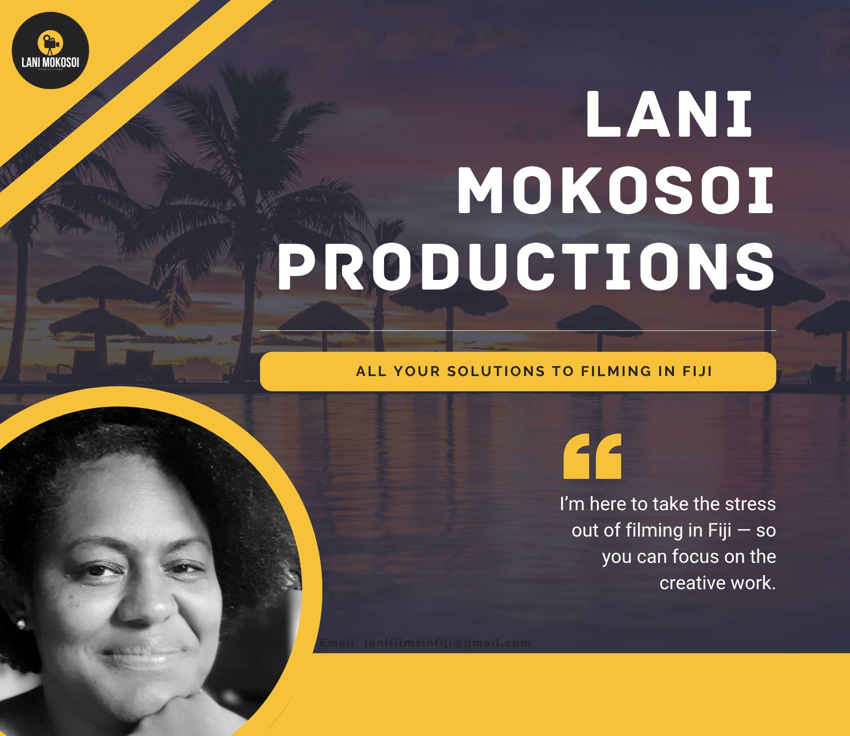
PRESENTED BY LANI MOKOSOI
FILMING IN FIJI?
|
I’ve spent more than two decades working in Fiji’s film industry, and I know how to get things done on the ground. Whether you need locations, approvals, transport, or crew, I’ll make sure your production runs seamlessly.
|
|
I’m here to take the stress out of filming in Fiji — so you can focus on the creative work.
|
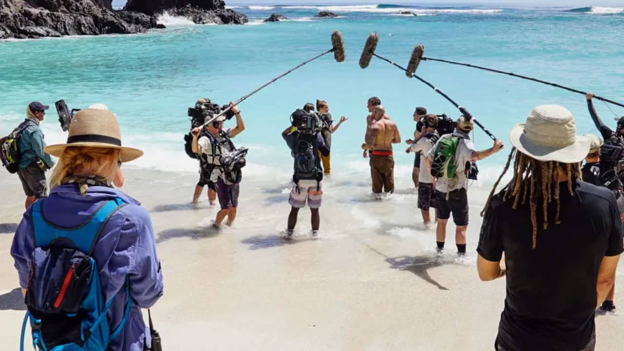
Memorandum of Understanding between Immigration and Film Fiji addresses processing delays for short-term, multi-entry production work. Photo credit: FBC News
Fiji Creates Dedicated Film Visa for International Crews
|
The Ministry of Immigration and Film Fiji signed a memorandum of understanding on December 15 establishing a dedicated film visa category designed for international production crews. Film Fiji CEO Jone Robertson stated the previous visa system was designed for long-term workers, causing delays for film crews who typically stay for short periods and travel in and out of the country several times during one project. The new visa allows crews to declare filming as their purpose of entry, improving data collection on production activity and planning. Permanent Secretary for Immigration Aliki Salusalu noted the agreement formalizes years of cooperation between the two agencies and will support timely processing while safeguarding border security and the integrity of the immigration system. Film Fiji has maintained a strong compliance record with low industry breaches over the years, according to Salusalu, who emphasized that international productions bring employment, skills transfer, and global exposure to Fiji.
|
|
The film industry contributed approximately $255 million to the Fijian economy in the 2023-2024 financial year and employed 1,200 locals, primarily driven by international productions including US Survivor, which has filmed in Fiji for nine years, and Love Island, shot in Pacific Harbour. In 2022, 66 productions created 826 jobs and generated $113.83 million in economic activity with $40.6 million in local expenditure. Productions like Survivor and Love Island reportedly spend between $20 million and $30 million per season filming in Fiji. However, Fiji faces increasing competition from countries offering higher incentives—Fiji maintains a $4 million cap per production with a 20 percent cash rebate, while Thailand offers 30 percent with no cap. Robertson told the Standing Committee on Public Accounts that many film commissions increased incentives during COVID-19 to attract productions for quick economic injections, noting that some productions film for three months but spend $20 million to $50 million in that period. If Fiji's incentive remains static, it becomes financially less attractive compared to competitors with similar economic size, locations, accommodation, and flight access.
|
|
The government commissioned an economic study with the Asian Development Bank to assess multiplier effects on employment and growth and recommend necessary incentives to support audiovisual industry development. The National Development Plan 2025-2029 and Vision 2050 emphasize streamlining processes by reviewing the existing regulatory framework and incentives. Film Fiji provides location services, administers the rebate process, grants film permits, and facilitates approvals from the tax department, immigration, and other government agencies while maintaining a database of experienced local crew and an online locations gallery. The organization has developed memorandums of understanding with Fiji Airways to reduce international travel costs for attending film markets in France, Australia, and New Zealand. Robertson stated that Film Fiji aims to attract investors to bring equipment into the country for use by both international and local filmmakers, enabling production of high-quality local films for overseas festivals and international markets.
|

Twenty-seven researchers from seven nations turn local problems into business prototypes during five-day UNESCO bootcamp. Photo credit: Joe Niemala / UNESCO
Pacific Scientists Develop Solar Fish Storage and Water Purifiers at Fiji Entrepreneurship Training
|
Twenty-seven Pacific scientists and engineers aged 20 to 34 completed UNESCO and ET Cube's first regional entrepreneurship bootcamp in Nadi, Fiji, from November 17 to 21, developing prototypes for solar-powered fish coolers, sun-powered water purifiers, and intelligent waste-sorting machines. Participants from Fiji, Kiribati, Samoa, Tonga, Solomon Islands, Vanuatu, and Papua New Guinea—all studying or teaching at the University of Technology in Papua New Guinea, Solomon Islands National University, University of the South Pacific, Fiji National University, or University of Fiji—identified challenges including clean drinking water access, waste management, ocean health, safe food storage for fishing communities, and climate pressure. One team designed a solar-powered cooler allowing fishermen in remote villages to preserve catches without ice, while another created a sun-powered water purifier for communities with poor access to safe drinking water. The bootcamp represents the fifth regional training UNESCO has conducted with ET Cube in three years, following programs in Egypt, Panama, Mongolia, and Angola.
|
|
The five-day program combined business fundamentals—including market analysis, business plans, and pitch development—with Pacific mentorship and real-world context rarely taught to young Pacific researchers. Participants worked with mentors including Aniruddh Kolekar, CEO of Fijian startup Paradise Group; Louis Newton from New Zealand accelerator Pacific Channel; and Jonnie Haddon from Fiji Innovation Hub. On the final day, five teams pitched their ideas to a jury posing as potential investors, which included Susan Schneegans, UNESCO Pacific Office Science Programme Specialist; Joe Niemala from UNESCO's Abdus Salam International Centre for Theoretical Physics in Italy; and Fiji's Permanent Secretary of Education Navin Raj. Fredson Massing from Vanuatu stated the training provided clearer frameworks, better problem-solving habits, and stronger understanding of real-world application. Solomon Islands fisheries students Gretchen Kapu and Natasha Wa'aria reported the experience exposed them to patent concepts and entrepreneurial mindsets they had never encountered in formal education.
|
|
The training addresses youth unemployment rates exceeding 30 percent in some Pacific nations. Samoa adopted its first National Science, Technology and Innovation Policy in February 2025 with UNESCO support, establishing innovation hubs, grants for new businesses, and simplified intellectual property protection laws specifically to reduce youth unemployment through technology-driven entrepreneurship. The policy supports Samoa's National Digital Economy Strategy and aligns with Pacific regional frameworks calling for greater digital inclusion and innovation. UNESCO's broader entrepreneurship education work spans the Asia-Pacific region through its Entrepreneurship Education Network (EE-Net), established in 2013, which now includes national chapters in nine countries focused on engaging policymakers, educators, researchers, entrepreneurs, students, and communities to enhance entrepreneurship education through research coordination, best practice dissemination, and policy recommendations. ET Cube founder Professor Raghu, an engineer from the University of Witwatersrand in South Africa who runs his own company and holds multiple patents, created the pitch competition format used across all five regional bootcamps.
|
ADB and World Bank co-finance Fanga'uta Lagoon crossing and drainage upgrades under new joint lending framework. Photo Credit: Talanoa O Tonga
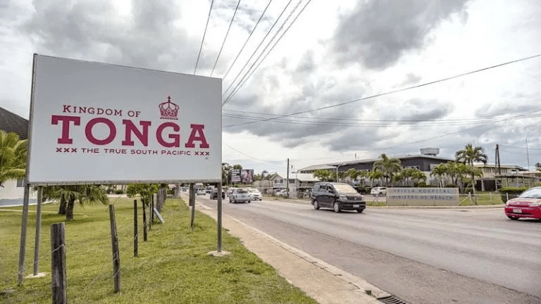
Tonga Receives $120 Million for Bridge and Flood Infrastructure in Largest Development Project
|
The Asian Development Bank approved an $80 million grant on November 20 for Tonga's Sustainable Economic Corridors and Urban Resilience project, with the World Bank expected to provide an additional $40 million in early 2026, making it the largest development-financed project in Tonga's history at $120 million total. The project will construct a 720-meter bridge across Fanga'uta Lagoon with 2.1 kilometers of approach roads, upgrade 7.3 kilometers of drainage infrastructure in Greater Nuku'alofa, and install measures to improve water security and reduce flooding. McConnell Dowell Constructors received the contract award in August 2025 after ADB issued no objection in July, with civil works expected to deliver over the coming years. The bridge will connect communities on the north and south sides of the lagoon, reducing traffic congestion and improving market access for rural residents while enhancing connectivity to the airport and port. The infrastructure also provides secure evacuation routes for communities in low-lying coastal areas during flooding, cyclones, and tsunamis.
|
|
Much of Nuku'alofa sits just 1 to 2 meters above sea level, leaving Tongatapu highly vulnerable to coastal flooding, storm surge, and tsunamis. The project addresses projected increases in rainfall intensity and flood frequency due to climate change, integrating planned infrastructure developments into a broader climate-resilient investment strategy for urban and peri-urban areas. The SECURE project represents the first infrastructure initiative delivered under the Full Mutual Reliance Framework, a partnership model allowing Pacific countries to work with a single lead lender—either ADB or the World Bank—that guides all aspects of project design, preparation, supervision, and evaluation. The framework aims to streamline processes, reduce duplication between the two institutions, and deliver faster project implementation with lower transaction costs while maintaining adherence to high policy standards. ADB President Masato Kanda stated the approach responds to client needs to solve complex challenges together, from disaster resilience to connectivity, while World Bank President Ajay Banga emphasized that Pacific countries requested the institutions work faster and serve as better partners.
|
|
The framework's first two projects include the $236.5 million Pacific Healthy Islands Transformation initiative in Fiji, led by the World Bank and approved by its Board, which will modernize primary health-care networks and support a new regional hospital to address noncommunicable diseases that rank among leading causes of death across Pacific island countries. ADB's proposed co-financing for the Fiji health project will be presented to its Board in early 2026, the reverse arrangement of the Tonga infrastructure project where World Bank co-financing follows ADB's lead approval. The operationalization of the framework in the Pacific reflects the already close partnership between the two institutions in the region and responds to needs of small island developing states facing capacity constraints in managing multiple development partners with different procurement systems, environmental safeguards, and reporting requirements.
|
Palau Advances Electronic Passport System with Technical Assessment
Third steering committee reviews findings as Luxembourg entity evaluates passport infrastructure under Japan-funded program
|
Palau's steering committee convened on November 25 for its third meeting to review initial findings from INCERT GIE's technical assessment of the nation's passport and identification systems, part of a three-year, $4.5 million initiative funded by Japan and implemented by the International Organization for Migration. INCERT GIE, a public entity established in 2012 by Luxembourg that manages the country's electronic passport and digital identity systems, signed an agreement with IOM on October 15 to conduct detailed evaluations of Palau's existing passport operations, including issuance and verification processes, legacy systems, institutional frameworks, and cybersecurity needs.
|
|
The assessment, which continues through May 2026, will produce recommendations for developing an ICAO- and ISO-compliant electronic passport system with embedded biometric chips designed to counter transnational crime, prevent identity fraud, and improve travel convenience. The Ministry of State chairs the steering committee, which includes senior representatives from the Ministries of Finance and Justice, the Judiciary Branch, and the Embassy of Japan as an observer, with IOM serving as secretariat.
|
|
The project will completely upgrade and digitalize Palau's passport application and issuance system, transitioning from traditional documents to electronic machine-readable passports containing biometric data that is difficult to forge. INCERT GIE serves as Luxembourg's official delegate to the International Civil Aviation Organization's Technical Advisory Group for the Traveler Identification Programme and participates in ISO committees developing standards on information security, cybersecurity, and privacy protection.
|
|
The organization's expertise in cryptography, public key infrastructure, electronic travel documents, and artificial intelligence positions it to address the technical complexities of establishing secure passport systems, particularly for small states lacking in-house capacity. Following the steering committee's review of initial findings, INCERT presented recommendations on steps needed to ensure Palau meets international security and quality requirements for passport issuance, with discussions focusing on legal frameworks, cybersecurity protocols, and human resource development necessary for long-term system management.
|
PRESENTED BY VONU STUDIOS
Children's Book: Vonu and the Druas Play Hide and Seek

|
Join Vonu the turtle and the stingray twins, the Druas Vai and Fai, in an exciting game of hide and seek! A heartwarming story filled with fun and adventure, perfect for young readers. Get your copy today!
|
UNESCO animated film illustrates Pacific geoparks using sites like Sāmoa's Mt Matavanu and Vanuatu's Yasur Volcano to promote geotourism and hazard education. Photo credit: PMN Cook Islands
UNESCO Film Spotlights Pacific Geosites for Geopark Development
|
UNESCO released an animated short film with the Pacific Community (SPC) and Pacific Tourism Organisation (SPTO) to explain geoparks to Pacific audiences, where only one exists in the South Pacific: New Zealand's Waitaki Whitestone. Geoparks designate unified areas for geological sites that integrate protection, education, and geotourism, with 229 worldwide across 50 countries. The film covers island formation processes, including hotspot volcanism in Sāmoa, Cook Islands, French Polynesia, and Micronesia, and subduction along the Ring of Fire in Tonga, Vanuatu, Solomon Islands, and Papua New Guinea.
|
|
Since 2020, UNESCO, SPC, and SPTO have inventoried geosites, such as Sāmoa's Savai’i with its Mt Matavanu eruption site from 1905-1911 featuring lava flows, craters, blowholes, and tubes. The International Union of Geological Sciences designated Matavanu, Vanuatu's Yasur Volcano, and Tonga's Hunga Volcano as geological heritage sites in October 2024, alongside Tuvalu's Funafuti Atoll. Aleni Fepuleai mapped Savai’i geosites since 2017, where Safotu villagers noted potential for tracks, signage, and facilities to support geotourism.
|
|
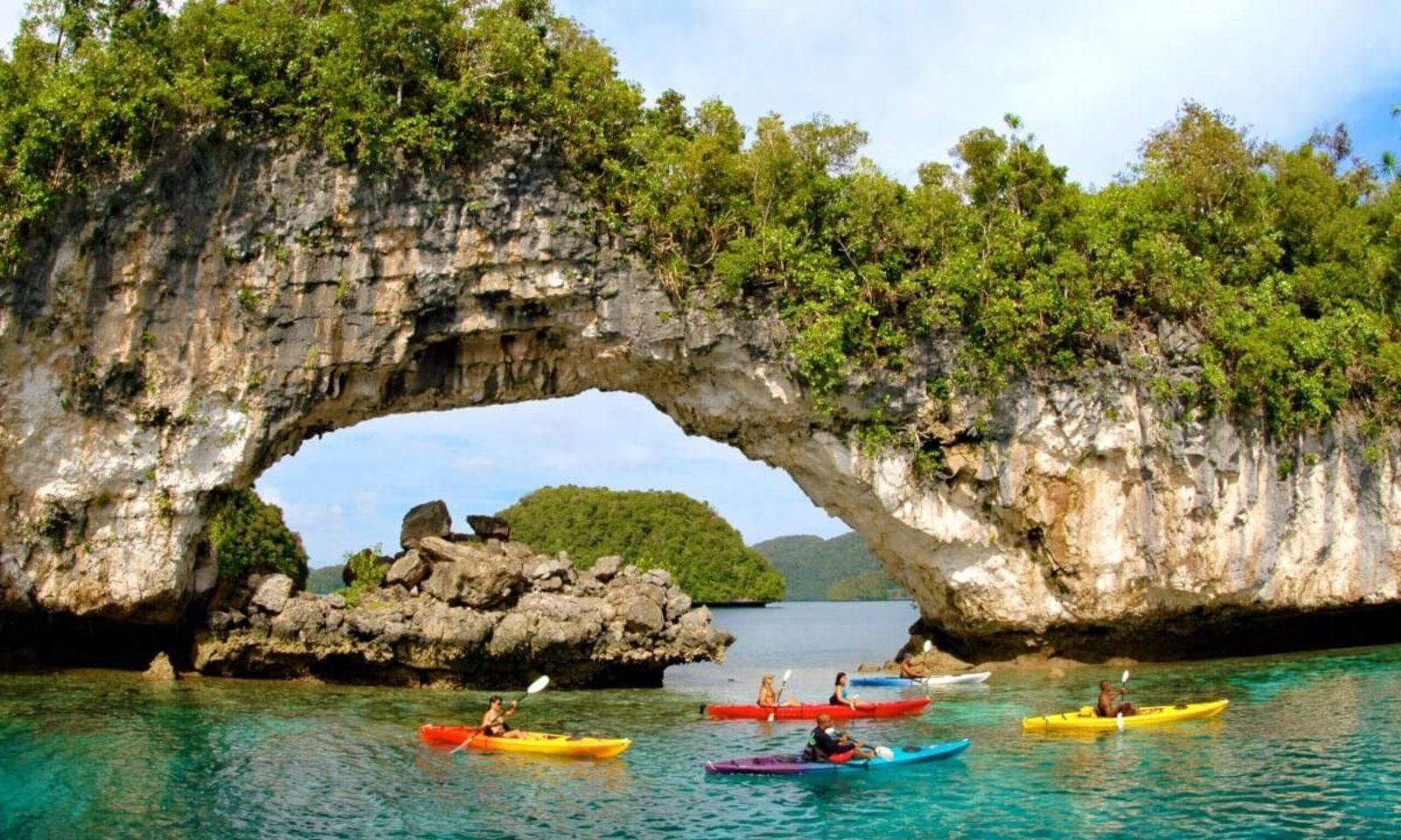
These efforts link geology to hazard awareness in the Ring of Fire, which hosts most active volcanoes and risks like earthquakes and tsunamis, while creating guide and conservation jobs. Atolls in Tuvalu, Kiribati, and Marshall Islands formed as subsiding volcanoes allowed coral reefs to build rings. Palau's Rock Islands, raised limestone reefs, hold UNESCO World Heritage status.
|
Kauaʻi Cultural Programs and Events Grant applications due December 31 support island events, Native Hawaiian practices, and visitor initiatives with $140,000 total funding. Photo credit: Hawaiʻi Department of Land and Natural Resources
Kauaʻi County Opens Cultural Programs Grant
|
Kauaʻi County Office of Economic Development accepts applications for the fiscal year 2026 Cultural Programs and Events Grant until December 31, 2025, at 4 p.m. HST via kauaiforward.com/grants. The $140,000 fund awards $5,000 to $15,000 per project for events and programs on Kauaʻi that preserve Native Hawaiian culture, support community activities, or advance visitor management under the Kauaʻi Destination Management Action Plan. Applicants need 10% cash match and 10% in-kind match, with administrative costs capped at 10% and quarterly reporting required through January 30, 2027.
|
|
Three OED staff score applications blindly based on criteria including cultural perpetuation and economic ties, with past cycles drawing 20-30 applicants, many repeats. Director Nalani Kaauwai Brun, who has led the 30-year program, notes it connects county resources to nonprofits, some of which later secure Hawaiʻi Tourism Authority funding like the $928,000 Kūkulu Ola program supporting Kauaʻi groups such as Pihana Ka ʻIkena and Mālie Foundation for hula festivals and workshops. FY2025 recipients included Pihana Ka Ikena, Garden Isle Resource & Development Corp., and National Tropical Botanical Garden for workshops, festivals, and heritage events.
|
CNMI Forum Questions Economic Gains from Federal Seabed Mining
Panelists at Northern Marianas College forum on December 3 discuss BOEM's deep-sea mining RFI for CNMI federal waters, emphasizing data gaps and federal control over revenues.
|
Economist Clement "CJ" Bermudez Jr told a forum on December 3 that the Commonwealth of the Northern Mariana Islands gains no automatic revenue from deep-sea mining in US federal waters within its 200-mile Exclusive Economic Zone, unlike independent nations such as the Cook Islands that issue their own licenses. All licensing, royalties, monitoring, and enforcement fall under federal control through the Bureau of Ocean Energy Management (BOEM), with any revenue share requiring an act of Congress. The targeted area lies roughly 128 miles east of Saipan, covering 143,595 square kilometers on the outer continental shelf near the Mariana Trench Marine National Monument.
|
|
Panelists at the Northern Marianas College event, including marine ecologist Kelsey McLennan, highlighted scant data on local ecosystems where polymetallic nodules and ferromanganese crusts form over millions of years and provide the abyssal plain's sole hard substrate. Mining could release plumes equivalent to 20 Olympic-sized pools of water carrying trace metals into the food chain, with past experiments leaving visible tracks decades later. Traditional navigator Cecilio Raiukiulipiy noted the site's role in voyaging via swells, currents, and temperature shifts, while CNMI and Guam leaders requested a 120-day comment extension on BOEM's November 12 Request for Information, receiving only until January 12, 2026.
|
|
John Gurley of Micronesian Environmental Services traced the RFI area to a 2009 agreement during Marianas Trench monument creation, where CNMI preserved fishing rights and mining potential, calling outright rejection premature without details on methods like turbidity plumes. Over 881 comments arrived by early December, mostly citing environmental and cultural risks, surpassing initial tallies in American Samoa where BOEM advanced despite 76,000 objections. NMC's Patricia Coleman urged submissions via the Federal Register to influence the process ahead of potential 30-year leases.
|
OCEANIANS MAKING WAVES
Samoan PhD Student Combines Traditional Food Knowledge with Genetics to Address Diabetes Crisis
 Amy Maslen Miller's research examines how island dietary practices and genetics influence metabolic health in Pacific communities facing epidemic rates. Photo credit: Amy Maslen Miller / LinkedIn
|
Amy Maslen Miller, a Samoan PhD student at a New Zealand university, is completing research that integrates traditional Samoan food knowledge with biomedical science to address type 2 diabetes in Pacific communities. Her study involved Samoan women participating in clinic assessments measuring blood samples, body composition, and metabolism, alongside talanoa about traditional foods. Pacific adults in Aotearoa have the highest estimated diabetes rate at 12.5 percent, followed by the Indian population at 9.5 percent and the Māori population at 7.0 percent. Among older Pacific people, nearly 48 percent of Pacific adults aged 65 to 74 have diabetes, including 47.7 percent of Samoan adults in that age group. A 2025 modeling study published in the New Zealand Medical Journal projects diabetes prevalence could rise by nearly 90 percent by 2044, with more than half a million New Zealanders expected to be living with the condition, and Pacific females facing the most drastic increases, with prevalence projected to reach 17 percent of the population by 2044.
|
|
Miller's work draws on a unique Samoan seasonal calendar documented by Penehuro Fatu Lefale and George Turner, a 19th-century missionary and author, which tracks foods in abundance, environmental indicators and seasonal changes. The research produces culturally tailored resources to help families make healthier choices without abandoning traditional diets. Miller, who was adopted into a New Zealand family but is biologically Samoan, previously completed a master's degree examining taro leaf blight disease before turning to human health. She described her approach as powerful because it provides a balanced view by combining Western scientific biomarkers and genetics with Samoan traditional knowledge, allowing her to document what Samoan traditional foods are while developing Western scientific skills to understand the genetics of Samoan women.
|
|
Diabetes New Zealand estimates that over 323,000 people currently live with diabetes nationwide, which has doubled in recent decades and continues to climb. Publicly-funded treatment for diabetes and its complications now costs New Zealand 0.67 percent of GDP, approximately $2.1 billion NZD per annum, with predictions estimating costs will reach $3.5 billion by 2040 in 2021 dollars, equal to 16 percent of the current health budget. Financial barriers compound the health crisis, with out-of-pocket health expenditure increasing on average 4.3 percent per annum compared to an average inflation rate of 2.7 percent and average median wage growth of 3.2 percent. Miller emphasized that her research aims to create health advice and resources realistic for people's lives, packaging knowledge to give back to the community so they can use these skills to influence their lives in terms of healthy eating and exercise, enabling them to live longer for themselves and their families.
|
SPORTS
Vanuatu's Manoa Tarroux Wins First ISA Heat for Pacific Nation
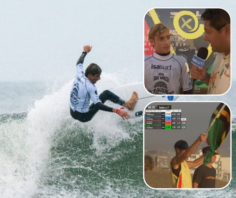 Sixteen-year-old defeats competitors from Spain and Colombia at World Junior Championships in Peru. Photo credit: The Vanuatu Surfing Association / Facebook
|
Manoa Tarroux became the first surfer to win a heat for Vanuatu at an International Surfing Association world championship on December 8, competing in the Under-18 division at Punta Rocas, Peru. The 16-year-old scored 12 points to defeat competitors from Spain and Colombia, including Romeo Chavez, a Colombian surfer with multiple ISA World Junior titles. Tarroux competed above his age category in six-to-eight-foot conditions during the final heat of Day 2 at the championship, which drew 424 junior surfers from a record 57 nations. The victory follows Vanuatu's debut at the ISA World Surfing Games in El Salvador in September, where Tarroux and teammates Sacha Ferry and Danylo David competed against 297 surfers from 61 countries, gaining experience that translated into Peru's result.
|
|
The World Junior Surfing Championship functions as a pathway to Olympic competition, with 59 of the 72 surfers who have competed at the Olympics having previously participated in the event, and 32 earning ISA World Junior medals. Vanuatu's team trains on the country's reef breaks, which Tarroux described as slabby, close to shore, and offering long rides—conditions that prepared the athletes for Punta Rocas' demanding lefts. National coach Ben Johnson has guided the development of the program, which gained momentum from the ISA Oceania Youth Development Program held in Fiji earlier this year. Tarroux told ISA media that the win validates extensive training and work, and expressed hope that the result will attract corporate funding to acquire boards for aspiring surfers in Vanuatu who lack resources to purchase equipment.
|
|
Vanuatu Surfing Association president Michael Barthelmess credited VASANOC (Vanuatu Association of Sports and National Olympic Committee) with supporting the organization's long-term vision of qualifying athletes for Olympic surfing. The Peru trip received funding from VASANOC, Titan FX, Vanuatu Breakas Beach Resort, and Australia Kava Shop. Tarroux competes alongside David and Ferry at the championship, which runs through December 14. The competition has already seen four nations—Angola, India, Saint Lucia, and Slovenia—participate in an ISA World Junior Championship for the first time, with Saint Lucia marking its inaugural ISA event of any kind. Brazil, Peru, and the United States currently lead team standings, while Australia seeks to defend its 2024 team title despite losing 2024 Under-16 gold medalist Ziggy Aloha Mackenzie to an MCL injury withdrawal.
|
SPOTLIGHT
Deep Trenches and Shallow Shelves: Why Small Pacific Islands Face Amplified Tsunami Risk
 New high-resolution modeling reveals counterintuitive physics that leaves island communities more vulnerable than previously understood. Photo credit: Mark Rabago / RNZ
TL;DR
New tsunami modeling shows the Mariana Trench and coral reefs amplify—not protect against—tsunami waves hitting the Northern Marianas. A major earthquake could send a 15-meter wave to Saipan in 10-15 minutes, hitting harder than Guam due to Saipan's shallow western shelf. Coral reefs don't stop tsunamis because they behave like fast-moving rivers, not storm waves.
|
|
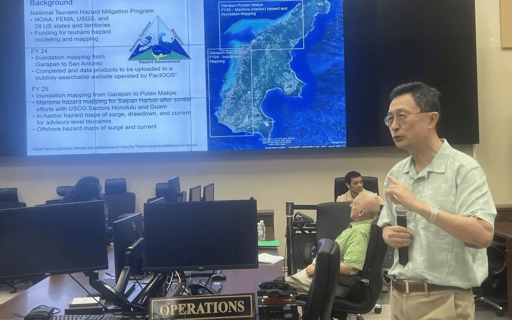
Dr. Kwok Fai Cheung, a professor of ocean and resources engineering at the University of Hawaii, presented updated tsunami inundation models for the Commonwealth of the Northern Marianas at a December briefing in Saipan, overturning public assumptions that have persisted for decades. The modeling, conducted under the US National Tsunami Hazard Mitigation Program using high-resolution LIDAR data, demonstrates that the Mariana Trench and coral reefs amplify rather than absorb tsunami energy—a finding with serious implications for Pacific island nations. A magnitude 8.3 or higher earthquake near the trench could send a 15-meter wave toward Saipan, Tinian, Rota, and the Northern Islands within 10 to 15 minutes. As tsunami energy moves from the deep trench toward shallower water, it compresses and wave height increases, a phenomenon amplified by Saipan's broad, shallow western shelf. Pacific forecaster Chip Guard, who joined Cheung at the briefing, stated directly that bathymetry focuses energy onto Saipan's west side, making the territory's exposure worse than neighboring Guam's despite similar distances from the trench.
|
|
The physics underlying this amplification applies broadly to small oceanic islands with certain bathymetric characteristics. Research published in Nature Physics in 2015 demonstrated that even tiny fluctuations in ocean floor profiles can cause unexpectedly strong variations in tsunami wave height, with maxima several times higher than average. A 2016 study in the Journal of Ocean Engineering examining continental slopes along the Indian coast found that flatter slopes lead to increased tsunami height through reduced reflection and enhanced shoaling effects—the same mechanism threatening Saipan's gentle western shelf. When tsunamis encounter shallow water, their velocity decreases while amplitude increases dramatically, transforming waves less than a meter high in deep ocean to heights exceeding 15 meters at shore. A 2021 study in the Journal of Geophysical Research documented how tsunami resonance caused by reflection and interference at bay edges and continental shelves amplifies wave heights and extends duration, noting that coupling between shelf resonance and bay oscillation modes produces even larger coastal hazards.
|
|
The misconception that coral reefs provide tsunami protection has proven deadly. While reefs dissipate energy from storm waves with periods of seconds, tsunamis behave like fast-moving rivers lasting 10 to 15 minutes—a fundamentally different phenomenon. Reefs direct tsunami flow upward and amplify energy rather than absorbing it, as Guard noted at the Saipan briefing when referencing the 2009 tsunami that killed 34 people in American Samoa and 159 in Samoa despite extensive reef systems. A 2013 review of tsunami risk management for Pacific Island countries and territories noted the poorly understood hazard related to local, regional, and distant sources, and the challenges of undertaking numerical modeling from generation to inundation that specifically relate to small island states. The paper emphasized that given the diversity of Pacific island nations, no single approach suits all locations, and that infrastructure planning must be tsunami risk-aware, including coastal setbacks, building construction styles, and where appropriate, designated no-build zones.
|
|
For the Northern Marianas, the modeling identified two distinct hazard scenarios with different characteristics and preparation requirements. Local tsunamis from the Mariana Trench arrive in 10 to 15 minutes with no practical warning time, while distant tsunamis from Japan's Nankai Trough arrive in 2.5 to 3 hours. Japan assigns a 60 to 94 percent probability of a full-rupture magnitude 8.7 event within 30 years at the Nankai Trough, making this distant threat statistically significant. The new projections for Saipan show water could travel past Beach Road into Lake Susupe with flow depths of 3 to 6 meters possible in the tourist district of Garapan and the school corridor along Beach Road. Several areas previously outside hazard zones—including the Mariana Beach Resort—would flood under credible worst-case scenarios. Older NOAA maps underestimated inundation because they relied on coarser elevation data and arbitrary magnitude assumptions rather than geophysically constrained scenarios based on actual fault characteristics and historical rupture patterns.
|
|
The evacuation challenge is particularly acute for islands with limited elevation options. Multiple public schools in Saipan lie within the inundation zone, and Mayor's office compliance officer Ray Dela Cruz noted that moving hundreds of students uphill within 10 minutes during a local event is not realistic. This reality extends to many Pacific islands where flat terrain, dense coastal development, and limited infrastructure create evacuation bottlenecks. A 2021 study on probabilistic tsunami hazard assessment for Fiji found that provinces in Viti Levu and Vanua Levu are susceptible to various tsunami inundation heights from Tonga-Kermadec and South New Hebrides sources, concluding that people and assets in provinces such as Macuata and Tailevu face particular vulnerability. Research on Northwestern Hawaiian Islands demonstrates how low-elevation Pacific atolls face compounded vulnerability from both tsunamis and sea level rise, with even small increases potentially resulting in loss of critical habitat and increased extinction risk for species restricted to these environments.
|
|
Both Cheung and Guard emphasized that residents should not wait for official alerts—if shaking is strong enough that standing is difficult and lasts 20 to 30 seconds, immediate evacuation to 15 meters or higher elevation is required without waiting for instructions. This self-evacuation protocol becomes critical for local tsunamis where warning systems cannot function fast enough. CNMI Homeland Security adviser Clement Bermudez stressed the need for stronger community education, additional sirens, and clearer messaging, stating the goal is not to scare but to accurately inform. The briefing represents a shift toward probabilistic tsunami hazard assessment that accounts for realistic earthquake scenarios, detailed bathymetry, and site-specific amplification effects—an approach that other Pacific island nations are beginning to adopt as computing power and data resolution improve.
|
|
The implications extend beyond emergency preparedness to long-term planning and development decisions. FEMA's National Risk Index, which influences mitigation funding distribution, depends on accurate exposure information, making updated evacuation maps essential for territories and island nations seeking federal assistance. The FY24 modeling for Saipan covers Garapan to San Antonio, with FY25 work expanding north to Puerto Rico and into the harbor, including maritime hazard maps for vessels. Cheung's team has developed similar models for Guam through partnerships with the Guam Department of Homeland Security, creating high-resolution hazard maps for Apra Harbor, Agana Bay, Tumon Bay, and Agat Coast. This work represents part of a broader scientific effort to understand how bathymetry, coastline geometry, and underwater topography interact to create localized amplification effects that can make neighboring communities experience vastly different impacts from the same tsunami source. For Pacific island nations scattered across subduction zones and volcanic arcs, this research underscores that geographic isolation provides no protection—and that the ocean floor itself can transform distant earthquakes into immediate, life-threatening hazards.
|
|
|
Help Us Improve The Oceanian
We’d love to hear your thoughts—reply to this email and tell us what you enjoyed or want more of.
|
QUICK TAKES
- Philippine Airlines plans nonstop flights from Manila to three Micronesia destinations —Koror in Palau, and islands in Guam and the Federated States of Micronesia— starting in the coming weeks. The Koror route launches March 29, 2026, with twice-weekly service using Airbus A320 aircraft, covering the 1,100-kilometer distance in about two hours and targeting divers and beachgoers with access to Palau's Rock Islands and marine sanctuaries. This expands PAL's Pacific network amid growing tourism demand from Filipino and Asian travelers.
|
FUNDING OPPORTUNITIES
-
NZ Film Industry Development Funding
|
The New Zealand Film Commission (NZFC)
is offering Industry Development Funding to support New Zealand screen sector organisations, companies, or collectives in delivering programmes that develop craft and practice within the film industry.
|
|
Key Details:
-
Purpose: To foster skill development, project initiatives, and talent within the New Zealand film sector.
-
Eligibility: Open to New Zealand-based screen organisations, companies, or collectives registered in New Zealand.
Funding Strands:
-
Strand 2 (up to $30,000): Applications opened on Monday, July 14, 2025 and remain open until June 30, 2026, or until funds are exhausted.
How to Apply: Applications are submitted via the NZFC's online application portal.
For full details on application criteria and guidelines, please visit the official NZFC website:
Industry Development Funding.
|
Was this email forwarded to you? Sign up here:
|
|